Austin, Texas · photographed 1998–1999 · web prototype circa 2000
A map became a doorway to the real world.
Years before Google Maps and Street View, Earth Traveler connected an aerial map of Austin to film-based panoramas, contextual writing, and place-to-place navigation. Its surviving files preserve parallel IBM HotMedia and Apple QuickTime VR versions.
- 38
- surviving viewpoints
- 9
- Austin place groups
- 25+
- years preserved
Grades 6–12 · geography and media literacy
How does the interface change what a map allows us to understand?
A paper map describes position. Earth Traveler added photographic evidence, descriptive writing, viewpoint sequences, and the choice to enter a location. Learners can compare the map with the panorama, notice what each representation includes, and identify what each leaves out.
The project also creates a media-history investigation. Its Nikon film capture, scanned panoramas, tiled aerial image, HotMedia files, QuickTime VR movies, and image-map links reveal how a spatial experience was assembled before modern web mapping.
“Could a person choose a place on a map, enter it, look around, and keep exploring?”
Curriculum connections include C3 geography practices, NCSS People, Places, and Environments, and CCSS ELA-Literacy RH.6–8.7 for integrating visual information with other sources.
Operational reconstruction
Choose a place. Enter the surviving panorama.
The photographic source is original. The tile conversion preserves that evidence; this new layer restores human-readable place names, grouping, sequence, and a contemporary way into the archive.
Bridge overlookFrom the limestone bluff
The original interface
A nine-tile map was the wayfinding system.
The original site divided an aerial image of Austin into nine map tiles and used image-map coordinates to connect real locations. Visitors could open a panorama, move forward or backward through a place, return to its aerial context, and choose another part of the city.
Two implementations survive. One loaded IBM HotMedia panorama files through a Java applet. The other opened Apple QuickTime VR movies. That dual authoring places Earth Traveler squarely inside the experimental rich-media web of its time.
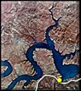
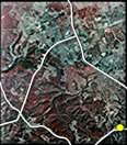
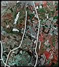
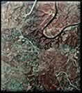
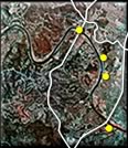
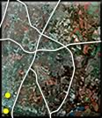
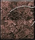
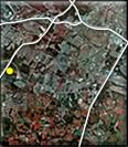
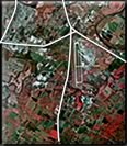 Recovered navigation map · circa 2000
Historical context
Early enough to matter. Documented enough to stand behind.
Earth Traveler was not the first interactive map or the first panorama. Its importance is more specific: it combined aerial-map wayfinding, real-place panoramas, contextual text, and non-linear web navigation before those ideas became ordinary consumer behavior.
The defensible claim: a pre-Google, map-linked panoramic city experience that demonstrates the educational and navigational potential of immersive place media years before mass adoption. It is a documented media-history comparison, not a claim of corporate lineage.
MIT’s Aspen Movie Map
The clearest early predecessor joined photographed streets to map and aerial-image navigation on an interactive videodisc system.
Computer History MuseumApple documents QuickTime VR
Apple’s SIGGRAPH paper described stitched 360-degree photographs, panoramic viewing, hotspots, and movement between photographic nodes.
SIGGRAPH paperIBM patents panoramic hotlinks
IBM filed patent work for interactive hotlinks in panoramic scenes, including links that could load another panoramic environment or trigger multimedia.
IBM patent recordTerraServer puts Earth imagery online
Microsoft and the USGS opened a web atlas of tiled aerial and satellite imagery, demonstrating public appetite for exploring place through imagery.
USGS historyEarth Traveler maps Austin
Earth Traveler connects 38 film panoramas, place descriptions, and aerial-map wayfinding in parallel HotMedia and QuickTime VR versions. The archive bears a 2000 copyright; its surviving FTP log records an April 2001 upload.
Surviving project archiveGoogle Maps launches
Google introduced its desktop map for directions and place finding, later expanding it into a broad platform for geographic exploration.
Google product historyStreet View enters the map
Google launched navigable 360-degree street scenes in five U.S. cities, bringing map-linked panoramic exploration to a mass audience.
Google launch announcement
Capture
Nikon film camera, wide-angle lens, multiple exposures per view.
Process
Physical film processing, scanning, stitching, and manual cleanup.
Publish
IBM HotMedia, QuickTime VR, image-map navigation, frames, and early HTML.
Recover
Modern multiresolution tiles, readable structure, and mobile access.
The next experiment